Paths & Trails
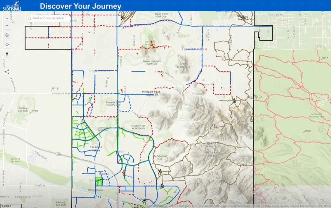
Path & Trail Maps
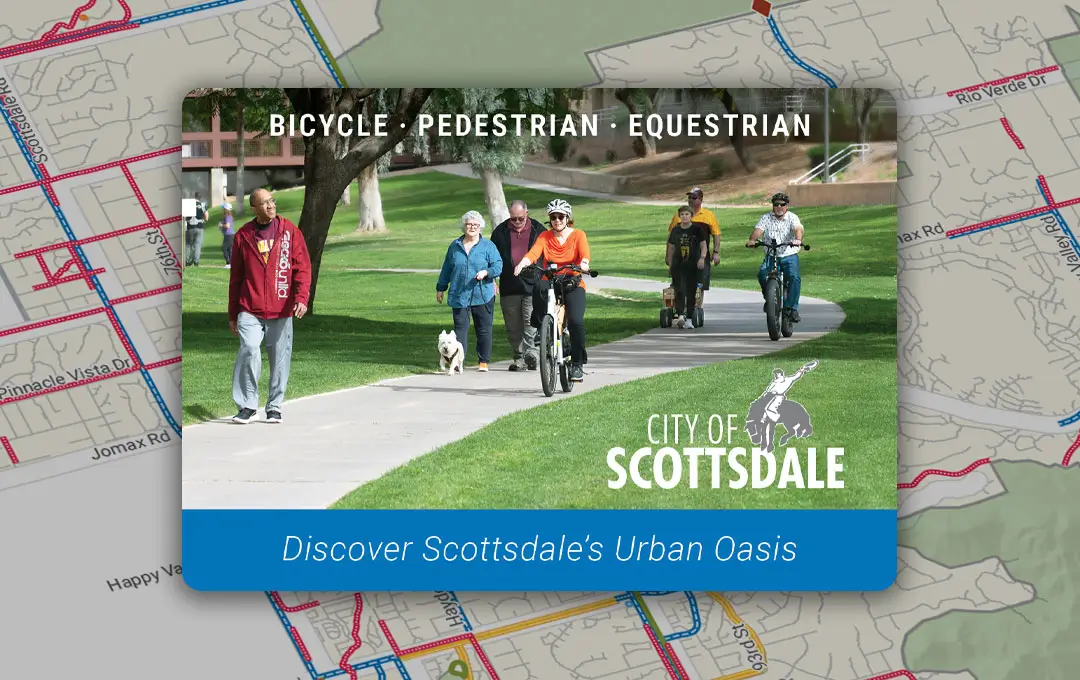
Discover Scottsdale’s Urban Oasis
Introducing Scottsdale's new Bike | Pedestrian | Equestrian maps featuring multiuse paths, unpaved trails, and on-street bike lanes. Scottsdale's multifaceted trail system is a fun and convenient way to get around the city. From a leisurely bike ride along the world-famous Indian Bend Wash to a horseback ride in the McDowell Mountain Range, we've got you covered.
Printed version of the map are available upon request. You can request up to 15 printed maps.
Multiuse Paths and Canal Trails
Scottsdale’s Indian Bend Wash multiuse path and the Crosscut and Arizona Canal trails provide local and regional connectivity.
- Indian Bend Wash (IBW) - Greenbelt
The Indian Bend Wash greenbelt, located in the heart of Scottsdale, is an oasis of parks, lakes, paths and golf courses. An 11-mile multiuse path runs through the greenbelt and features more than 24 underpass and bridge crossings; this means that users avoid crossing streets at major intersections and enjoy uninterrupted travel.
- Arizona and Crosscut Canal Trails
At almost 70 miles long, the Arizona Canal trail is one of the longest in Maricopa County. The trail runs along both sides of the Arizona Canal and connects Scottsdale to Peoria, Glendale, Phoenix, and the Salt River Pima-Maricopa Indian Community. One of the highlights of the trail is Scottsdale’s Soleri Bridge and Waterfront entertainment and event venue.
The Crosscut Canal trail intersects with the Arizona Canal trail near Indian School Rd. and 64th in Scottsdale. The 4.5-mile trail runs along the canal bank through residential areas and offers connections to Scottsdale’s popular Old Town shopping, dining, and entertainment areas. The trail ultimately winds its way through the Papago Park recreation area and ends in Tempe.
Neighborhood Trail System
Scottsdale's neighborhood trail system provides valuable recreation and transportation opportunities for city residents and visitors. Our unpaved trails serve as transportation links between schools, neighborhoods, McDowell Sonoran Preserve trailheads, parks, places of employment and other areas of interest. Trails are a place for residents and visitors to spend time with friends and family in the beautiful Sonoran Desert in a peaceful and protected setting.
Scottsdale has 160 miles of trails with an additional 150 miles of trailways planned for future construction.
List of Unpaved Trails:
Trail Resources
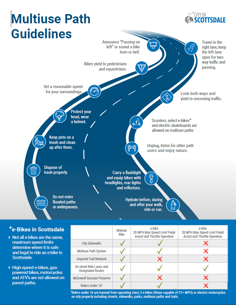
Trail Etiquette
Scottsdale residents and visitors use the city's trail system for the same reason - to enjoy the outdoors and beauty of the Sonoran desert. Please help the city maintain our trail system by obeying all signs and acting responsibly when traveling on the trails.
The universal rule of trail courtesy is for all trail users to yield the right-of-way to horses, and for bicycle riders to yield to all other types of users. When approaching a person on horseback, speak in a soft voice to alert the horse and rider of your presence.
You can be fined up to $250 for driving a motorized vehicle on an unpaved trail in the city of Scottsdale. The city prohibits the use of motorized vehicles, including ATVs and motorcycles, on Scottsdale's trails and in the McDowell Sonoran Preserve.
Last Updated: Apr 24, 2026
Transportation & Infrastructure
7447 E. Indian School RoadSuite 205
Scottsdale, AZ 85251
- 480-312-7250
- 480-312-4000 (TTY)